

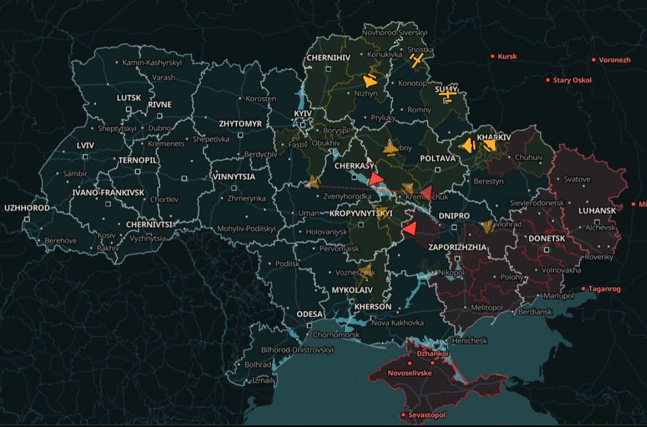

The Ukrainian monitoring project monitor has launched a beta version of an online map that allows users to track air raid alerts and the approximate movements of Russian drones and missiles. The developers have also designed the service for users with slow internet connections, with the basic version of the map requiring only around 200 KB of data.
The team announced the launch on X. The map is available at map.war-monitor.org.
The map shows the approximate locations and directions of Russian drones, cruise missiles and ballistic missiles. Regions, districts and communities under air raid alerts are highlighted in yellow and red.
The full version also allows users to view a target's previous flight path and its likely direction of travel. Information for each target includes its type, location, heading and the time of the latest update.
The service initially loads a simplified map of approximately 200 KB. A more detailed version, around 1.8 MB in size, loads later. For users with slow connections or data-saving mode enabled, the detailed map is downloaded only upon request.
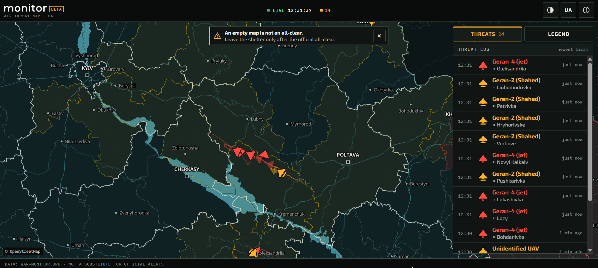
When aerial threats are detected, the map updates approximately every 20 seconds. When no targets are present, updates occur every 45 seconds. Users do not need to refresh the page manually.
The service also warns users when information has not been updated for an extended period. Target markers gradually fade, and if new data stops arriving, a "STALE" warning appears.
The map receives information about aerial targets from war-monitor.org, while air raid alert data is provided by alerts.in.ua.